The Parish Maps of Trøst-Hansen
Churches and Schools of Denmark
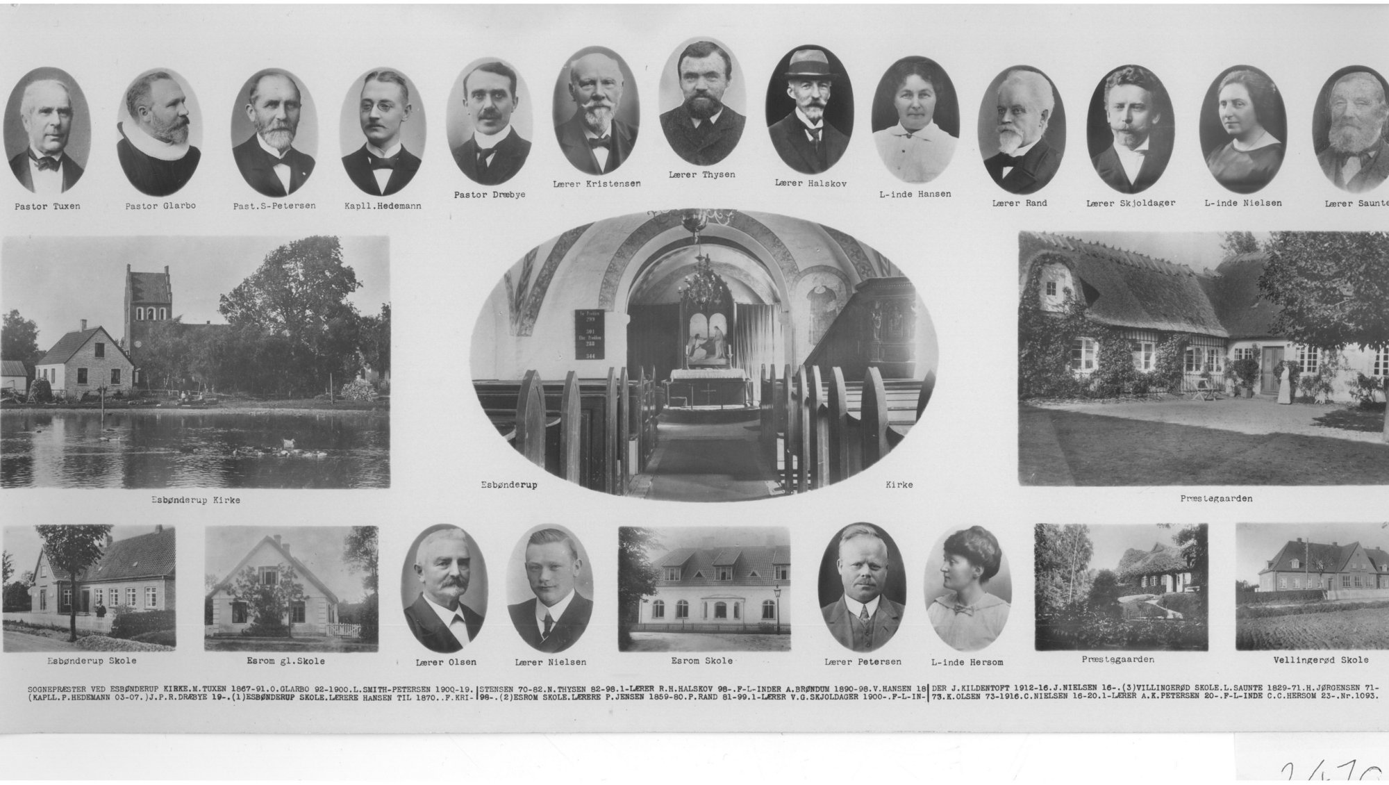
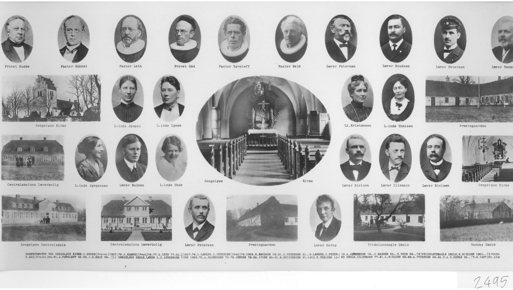
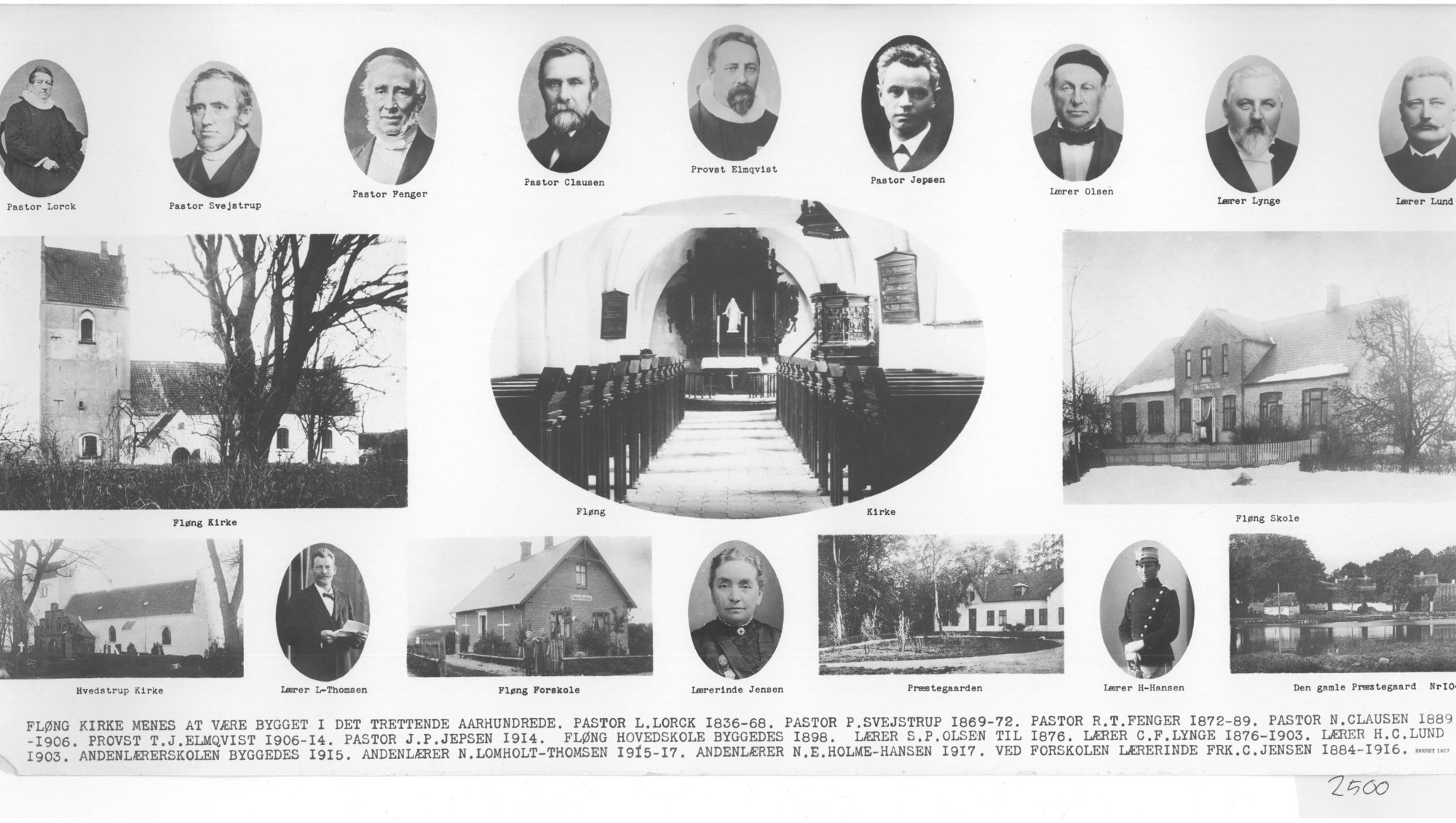
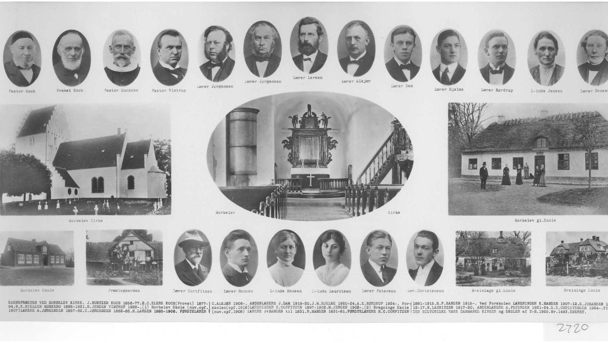
In 1917, with support from the former Danish School Museum, later the Danish Educational Library, the merchant Trøst-Hansen set forth to document all parishes in Denmark, both in terms of churches and schools and respective employees, current and former. The work was called: Churches and Schools of Denmark. There were more than 2000 parishes in Denmark at the time, but unfortunately, Trøst Hansen never completed the mission. Therefore, the collection does not contain any maps from Copenhagen, Sokkelund shire or the market towns. We have 856 parish maps in our collection. Digitized and available.
You will find all the digitized parish maps in the left-menu, arranged by county, according to the county boundaries determined in 1970. If you need more information about county boundaries and shires, we refer you to DIS-DANMARK's maps.
If you know of a parish card that is not in the collection, please let us know.